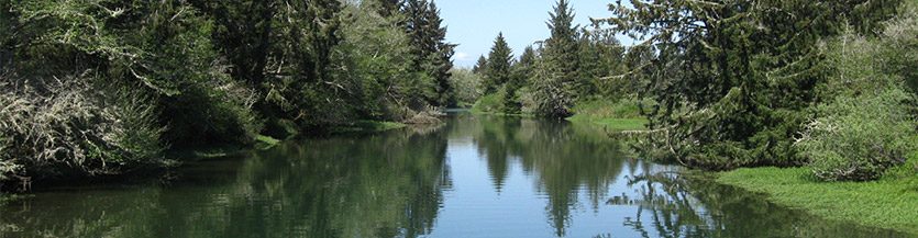
Overview
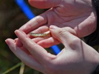
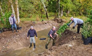
Photo by Paul Dunn
The ultimate goal of the Chehalis Basin Collaborative for Salmon Habitat is to help implement on-the-ground, community supported, salmon recovery projects in the Chehalis watershed.
We do this by developing, planning and prioritizing salmon restoration and preservation projects that follow the guidance of the Chehalis Basin Salmon Habitat Restoration and Preservation Strategy.
A primary role of the group is to help allocate state and federal salmon recovery (SRFB) funding. Because these grant monies are limited, a process is needed to identify the projects with the most benefits to salmon in the Chehalis system. The Chehalis Basin Collaborative for Salmon Habitat is responsible for running that process.
Salmon recovery projects benefit more than just salmon. They protect agricultural lands, provide flood protection, fix roads, bridges and other infrastructure, and create tourism and recreational opportunities. Because projects are managed at a local level, they help bring money into the local communities.
From 1999 to 2022, salmon recovery projects have brought $19,944,000 of state and federal funds into the Chehalis Basin through our work.
Our Role in Washington's Salmon Recovery
When Washington’s salmon populations were listed under the Federal Endangered Species
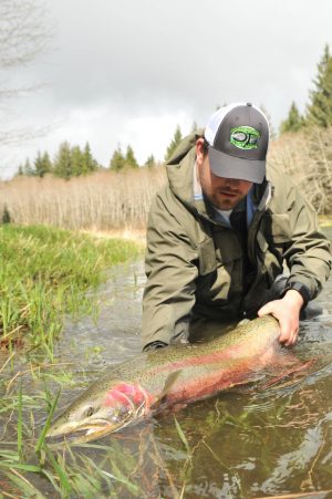
Photo by Luke Kelly
Act in the 1990s, state leaders decided they did not want the federal government telling them how to recover and protect these iconic Pacific Coast species. Instead, they proposed a bottom-up approach that let local communities to write their own recovery plans. In each major watershed across the state, communities have written recovery plans, which are now being implemented by Lead Entities. In the Chehalis Basin, a group of citizens and local technical experts wrote this region’s salmon recovery plan and updated it in 2011. The plan is called “The Chehalis Basin Salmon Habitat Restoration and Preservation Strategy for WRIA 22 and 23.” The strategy lists seven ways that the threats to salmon can be reduced through on-the-ground habitat restoration projects.
Today, the Basin Collaborative for Salmon Habitat (Lead Entity) coordinates the work of hundreds of volunteers and professionals to implement the recovery plan in order to restore salmon to our rivers.
What we have accomplished (1999-2018):
54 fish passage barriers corrected
182 Stream Miles made accessible
89 Miles of Riparian area treated
237 Structures placed in streams
123 Acres offchannel reconnected
2,453 Acres of estuary, riparian area, and uplands conserved
Organizational Structure
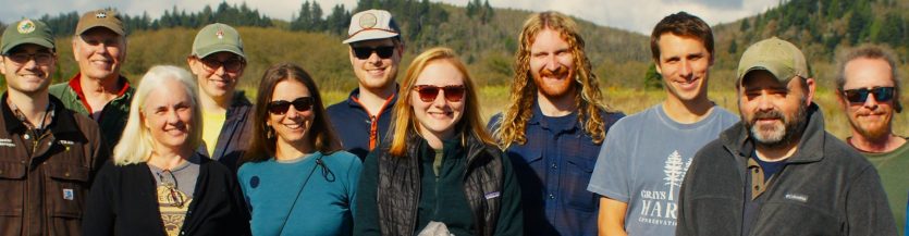
It takes a lot of different people working together to implement the Chehalis Basin’s salmon recovery plan. Many organizations in the Chehalis are working towards salmon recovery. The Collaborative structure brings them together to decide on the most strategic way to take on salmon recovery in the Chehalis. The work of the Chehalis Basin Collaborative for Salmon Habitat is undertaken by members of dozens of stakeholders in salmon recovery in the Chehalis Basin. These include: cities, counties, conservation districts, tribes and Indian Nations, non-governmental conservation organizations, land trusts, business interests, landowners, citizens, regional fish enhancement groups, as well as and state agencies.
Habitat Work Group
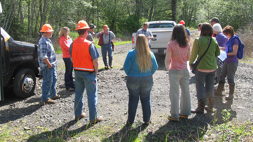 The Habitat Work Group is the steering body for the Lead Entity. It is composed of local citizens and technical experts with an interest in improving the habitat conditions for fish in the Chehalis. Throughout the year, they look for projects that will help meet goals for salmon recovery as outlined in the Chehalis Basin Lead Entity’s Strategy. They look for sponsors who will undertake salmon recovery projects on the ground and coordinate review and ranking of projects that will be proposed for state funding. In 2020, our Habitat Work Group includes representatives from:
| Lewis Conservation District | Grays Harbor Conservation District |
| Mason Conservation District | Citizens of Thurston, Lewis and Grays Harbor Counties. |
| Thurston Conservation District | The Nature Conservancy |
| Quinault Indian Nation | Chehalis Tribe |
| Chehalis River Basin Land Trust | Capitol Land Trust |
| Chehalis Basin Fisheries Task Force | Wild Fish Conservancy |
| Lewis County | Thurston County |
| Port of Chehalis | Washington Department of Ecology |
| Washington Department of Fish and Wildlife | US Fish and Wildlife Service |
| Conservation Commission | Aquatic Species Restoration Plan |
Local Review Team
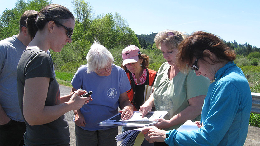 Since evaluating the technical merit of each proposed salmon recovery project takes a lot of time, a smaller group is needed. The Local Review Team is a subcommittee appointed by the Habitat Work Group to carry out the work of reviewing and ranking projects proposed for salmon recovery funding. They look for projects with the highest benefits to salmon that best meet the goals of the Chehalis Lead Entity’s Salmon Strategy. The Local Review Team can consist of representatives of counties, cities, state and federal agencies, conservation districts, tribes, environmental groups, business interests, landowners, citizens, volunteer groups, regional fish enhancement groups. Membership of the Local Review Team is not restricted to members of the Habitat Work Group. Citizen participants ensure that the projects reflect the interests and values of the citizens within the watershed. To join the review team, contact us.
Lead Entity Coordinator
The Lead Entity Coordinator is in charge of the operations of the Lead Entity. Get in touch with the Lead Entity Coordinator if you have an idea for a habitat restoration project, want to serve on an advisory committee, want to know more about the Chehalis watershed, or have any other questions: Contact Us!
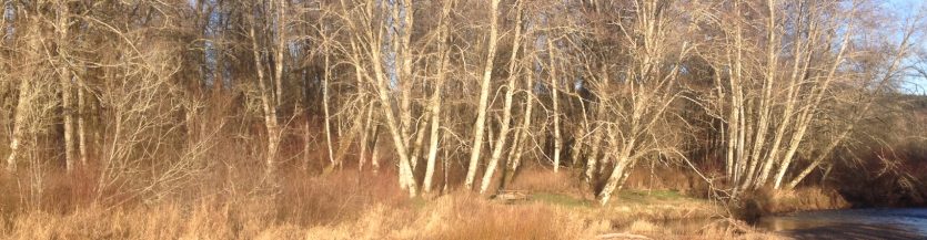
The Chehalis Watershed
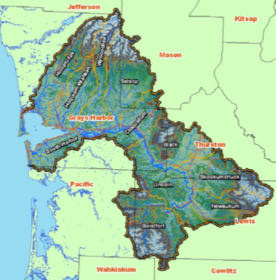 The land and rivers the Basin Collaborative for Salmon Habitat works in include the main stem of the Chehalis River and all of its tributaries, as well as the smaller rivers flowing into Grays Harbor. The Chehalis River starts in the Willapa Hills near the city of Pe Ell, picks up water contributed from the slopes of the Olympic mountains, and then flows into the Grays Harbor Estuary and then on to the Pacific Ocean. Within 2,700 square miles there are over 3,300 miles of rivers and streams that support six anadromous salmonid species. Unlike in other regions of Washington State, the salmon found in the Chehalis are not endangered. Studies Done on the Chehalis Watershed
Subbasins
There are eleven major tributaries to the Chehalis River. The land surrounding these tributaries is considered a separate sub-basin of the Chehalis River. In the Chehalis Basin Lead Entity Strategy, each sub-basin (also called Management Unit) has been reviewed and its unique needs for supporting salmon recovery have been identified.
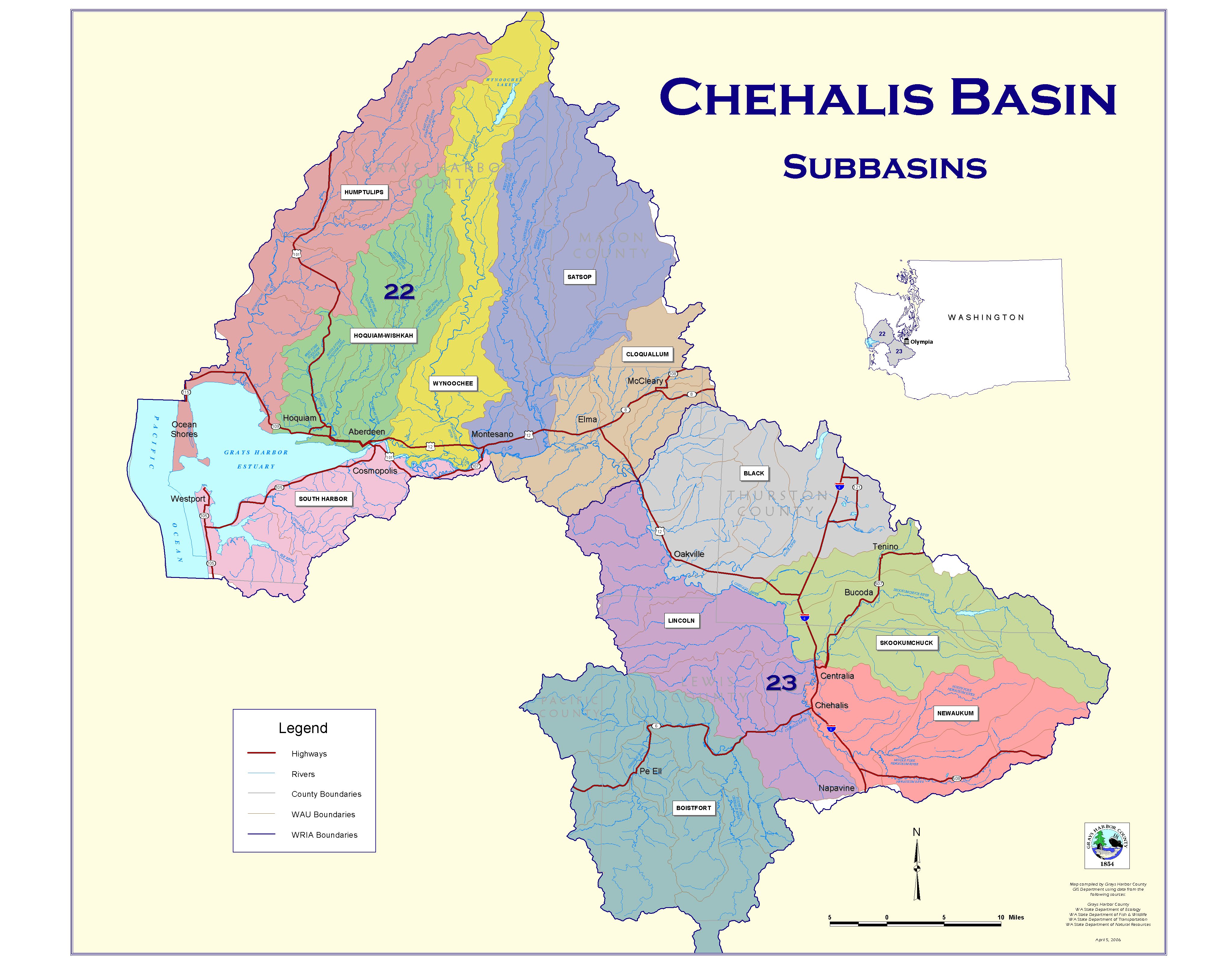
The 11 major subbasins in the Chehalis Watershed
 Further, each of these 11 sub-basins (Management Units) is divided into approximately four additional sub-basins (WAU) with unique salmon habitat information.
The Habitat Work Group, along with expert consultations from conservation biologists, assigned the limiting factors with each sub-basin (Management Unit) and some WAU to one of three “tier” concerns.
“Tier 1” concerns are those most pressing issues in a sub-basin that limit salmonid abundance, productivity, and diversity. The preference of the Lead Entity is that salmon recovery projects that address Tier 1 concerns are first in line for implementation due to their potential for providing the greatest benefit to fish. Tier 2 concerns are the next highest priority.
**NEW** You can see the Management Unit and WAU boundaries that correspond to tiered concerns on the state’s Salmon Recovery Portal – link here: https://srpsecure.rco.wa.gov/sitemap
Subbasin Priority Limiting Factors
A summary of “Tier 1 and Tier 2” concerns by sub-basin (Management Unit + some WAU) is provided below. Please see the Chehalis Basin Lead Entity Strategy for details.
| Sub-Basin | Tier 1 Concern | Tier 2 Concern |
|---|---|---|
| Black River | Water Quality Riparian Water Quantity | Large Woody Debris Fish Passage |
| Boistfort | Fish Passage Sediment Riparian | Large Woody Debris Water Quality |
| Chehalis Mainstem | Riparian Water Quality Floodplain | Large Woody Debris Water Quantity |
| Cloquallum | Fish Passage Riparian Water Quantity | Floodplain Sediment |
| Grays Harbor Estuary Management Unit | Water Quality Total Estuary Habitat Loss | Exotic Species Sediment Tributary Connectivity Surge Plain |
| Hoquiam | Water Quality Fish Passage Riparian | Floodplain Sediment |
| Wishkah | Sediment Riparian Fish Passage | Floodplain Large Woody Debris |
| Humptulips | Water Quality Fish Passage Sediment | Riparian Floodplain |
| Lincoln | Further divided by subwatershed | |
| Newaukum | Further divided by subwatershed | |
| Satsop | Floodplain Water Quality Riparian | Fish Passage Large Woody Debris |
| Skookumchuck | Floodplain Riparian Fish Passage | Water Quantity Water Quality |
| South Bay | Fish Passage Sediment Riparian | Large Woody Debris Floodplain |
| Wynoochee | Fish Passage Riparian Floodplain | Water Quality Sediment |
Focus on The Newaukum
The Newaukum watershed’s headwaters is the site of a new approach to salmon habitat restoration in the Chehalis Basin and on Washington’s outer coast. A new “Prioritized Restoration Plan” was developed in 2023. The plan goal is to address the highest priority restoration and protection goals in a single watershed in a defined timeframe that will generate a detectable response in fish productivity.
Read more here: https://www.coastsalmonpartnership.org/current-initiatives/pwr/
Focus on the Newaukum: History
In 2014, Chehalis Basin Lead Entity initiated an update of its restoration strategy with the goal of providing more detailed assessment of limiting factors, data gaps, restoration targets and project lists. Given the size of the basin (the second largest in the state), the group opted to work through each of the watershed’s 13 subbasins. A subcommittee of the Lead Entity’s Habitat Work Group (HWG) completed an update for the Humptulips in late 2014, and the Newaukum was selected for the update in 2015. In 2015, the Washington Coast Region advanced a “pilot watershed” approach to guiding restoration along all coast Lead Entity areas. The Region’s plan was to assist each Lead Entity with scientific assessment and bringing additional resources to bear on restoration. To demonstrate successes, the work would need to occur in smaller “pilot” areas and could then be replicated elsewhere. The Chehalis Basin Lead Entity’s Habitat Work Group once again landed on the Newaukum for their selected watershed. When the Fish Barrier Removal Board made the request for a Watershed Pathway to barrier removals in the Chehalis, it made sense to also choose the Newaukum in order to focus more resources there.
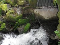
Student water quality monitoring in the Newaukum watershed. Photo by Paul Dunn
The group identified many benefits of attempting a comprehensive restoration program in the Newaukum: existing landowner involvement and approachability in key areas; relatively low number of barriers compared to the rest of the Chehalis; good habitat and water temperature conditions in tributaries; and research and monitoring work starting as part of the Chehalis Strategy. Along with the above mentioned work, a variety of other projects have begun in the Newaukum. The Department of Ecology’s Watershed Assessment program chose the Newaukum for effectiveness monitoring (one of only about a dozen in the state), and its’ Nonpoint Pollution Reduction program will target this watershed in working with landowners to find non-regulatory solutions to reducing water quality pollution. The USFWS is conducting a lamprey use survey. The Wild Fish Conservancy is conducting a watertyping study for unmapped streams in the South Fork of the Newaukum. The Lewis County Conservation District has been working with landowners to identify bank erosion and protection projects. WDFW is conducting a number of other studies including a summer juvenile fish use. All of this work will generate new environmental data for the Newaukum and will lead to projects that will be more effective for having taken place in concert.
Newaukum Watershed Data Resources
 Implementing watershed clean-up and restoration in a coordinated manner requires access to information about past and proposed projects, fish use, habitat conditions, water quality, and other data. Below is a list of data available for the Newaukum Watershed:
Newaukum River Effectiveness Monitoring – A story map by Ecology connecting monitoring data to restoration effectiveness evaluation
Coast Salmon Partnership Models – Newaukum
Wood placement model to identify best places for instream restoration. Riparian model to identify best places to inform riparian restoration.
Salmon Recovery Portal Click on “Salmon Recovery Organizations: Chehalis Basin Lead Entity”
Chehalis Basin Fish Passage Barrier Priorities Learn where there are still barriers to fish passage. This map is for the whole basin, but will also be useful for understanding barriers and opportunities to fish habitat recovery in the Newaukum.
LiDar Portal LiDar is an image of the landscape taken from the air that reveals landscape forms. It is helpful in understanding river dynamics and habitat conditions. This link provides access to LiDar data in the Newaukm and throughout Washington State. http://lidarportal.dnr.wa.gov/
EPA Water Quality Data: To access water quality data collected by the Chehalis Tribe for the Chehalis, including the Newaukum, look for organization code CHEHALIS_WQX.
Wild Fish Conservancy GIS – Includes Water-Typing results from the Middle Fork Newaukum River. https://wildfishconservancy.org/interactive-maps/
Washington Coast Region
The Chehalis Watershed is part of the Washington Coast Region, since the Chehalis River drains directly to the ocean along Washington’s Coast. The Chehalis Lead Entity work, therefore, is nested within regional salmon recovery efforts as part of the Coast Salmon Partnership. The Coast Salmon Partnership guides the long-term protection and restoration of Washington Coast’s salmon and steelhead populations in some of their last best habitats in the continguous United States. They work to restore their populations to numbers more resemblant of historic health through an ‘all-H’ strategy that tackles issues associated with habitat, harvest, hatcheries, and hydropower. They help coastal communities thrive by collaborating with partners to develop project solutions that put people to work to ensure the long-term health of the region’s iconic salmon and steelhead. The Washington Coast Sustainable Salmon Plan outlines a way to achieve their vision: “All watersheds in the Washington Coast Region contain healthy, diverse and self-sustaining populations of salmon maintained by healthy habitats and ecosystems which also support the ecological, cultural, social and economic needs of human communities.” See their webpage for more details: Coast Salmon Partnership
Project Showcase
Middle Fork Hoquiam Tidal Restoration
The project restored full tidal function to 113 acres and removed 10 fish barrier culverts that
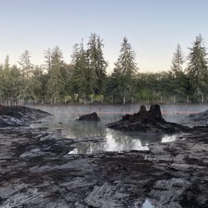
Breach Day at M.F. Hoquiam tidal restoration project, September 2021
block fish access to tidal wetlands in the lower Middle Fork Hoquiam River on land owned by the Chehalis River Basin Land Trust. The Grays Harbor Conservation District will plant spruce trees in 45 acres of alder-dominated forest to speed the development of conifer-dominated forest composition. The newly available tidal wetlands will be available for juvenile salmon rearing of chum and Chinook salmon and steelhead trout.
Funded by: Salmon Recovery Funding Board & Washington Coast Restoration and Resiliency Initiative.
Sponsor: Grays Harbor Conservation District
Completed: 2021
Cost: $2,250,000
More information: https://srp.rco.wa.gov/project/120/82204
Bush Creek 3 Barrier Correction
This project removed three 33% passable fish passage barrier culverts on Bush Creek near Elma
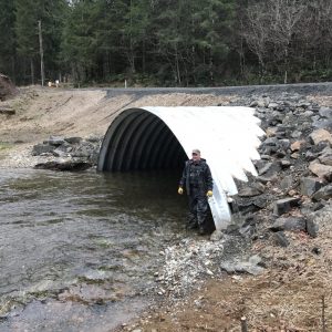
Bush Creek site#2
and replaced them with structures that are fully passable to all aquatic species and life stages. Together, they opened a total of 8.44 miles of upstream, forested spawning and rearing habitat for 5 species of salmonids.
Funded by: Salmon Recovery Funding Board and Aquatic Species Restoration Plan (ASRP)
Sponsor: Chehalis Basin Fisheries Task Force
Completed: 2020
Cost- design and construction: $892,349
More information: https://srp.rco.wa.gov/project/120/81394
Frase Creek Barrier Removal
This project replaced an impassable culvert with a fish passable structure. Work was also done
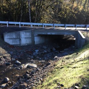
Frase Creek crossing after completion.
to realign the upstream channel to a more natural state. Frase Creek, a tributary to the South Fork Newaukum, east of Onalaska, is now fully accessible to 2.74 miles of rearing and spawning habitat for Coho and steelhead.
Funded by: Salmon Recovery Funding Board and Aquatic Species Restoration Plan (ASRP).
Sponsor: Lewis County.
Completed: 2020.
Cost – construction: $850,371
More information: https://srp.rco.wa.gov/project/120/80361
Wisner Creek Channel Reconnection
The Lewis Conservation District and the local landowners improved a section of Wisner Creek,
Planting along newly created channel, October 2016
located about 2 miles west of Chehalis in Lewis County. The Conservation District created a new channel as well as planted trees and bushes on the channel’s banks and sprayed to manage the invasive reed canary grass. The new channel is about 400 feet long with a meandering structure that will allow Coho, steelhead, and cutthroat access to about 1.75 miles of previously unreachable habitat.
Funded by: Salmon Recovery Funding Board
Sponsor: Lewis Conservation District.
Completed: 2018.
Cost: $35,468
More information: https://srp.rco.wa.gov/project/120/80443
Chehalis Basin Fish Screening - Phase 2
The Lewis Conservation District has been working with irrigators in the Chehalis Basin since 2014. One need that was discovered was WDFW-compliant fish screens for irrigation intakes. These screens prevent juvenile Coho, chinook and steelhead from being sucked into irrigation systems. This project installed 23 fish screens on irrigation intakes in the Chehalis Basin.
Funded by: Salmon Recovery Funding Board and US Fish and Wildlife Service
Sponsor: Lewis Conservation District
Completed: 2020.
Cost: $65,594
Newskah Road Fish Barrier Correction
This project supports salmon habitat in a stream directly connected to the Grays Harbor  estuary. It provides access to forested streams for Coho, chum, steelhead and searun cutthroat trout. A project sign that lists funders and supporters is posted at the road crossing. Only one more barrier needs correcting, then the entire watershed will be open to spawning and rearing fish.
Sponsor: Chehalis Basin Fisheries Task Force.
Completed: 2021
Cost: $312,300
More information: https://srp.rco.wa.gov/project/120/81693
Black River Conservation - Ramos Acquisition
This property acquisition protected 54 acres of Black River floodplain, including approximately 2,200 feet of the Black River (both banks) and more than 7,000 feet of side channel. The majority of habitat is a rare wetland habitat type, unique to the Black River and identified by Washington Natural Heritage Program as low elevation riparian wetland. The river supports crucial habitat for numerous priority species including Chinook, steelhead, Coho, chum, coastal cutthroat trout. The property is adjacent to 75 acres conserved by Capitol Land Trust in 2006, and protection resulted in the continuous and perpetual conservation of over 4,000 feet of the Black River.
Funded by: Salmon Recovery Funding Board
Sponsor: Capitol Land Trust
Completed: 2018
Cost: $124,810
More information: https://srp.rco.wa.gov/project/120/19428
Mills Property Acquisition
Creekside Conservancy bought and protected 29 acres of white oak habitat along 0.5 mile of
Scatter Creek running through Mills property, 2014
Scatter Creek south of Rochester. The creek is home to coho, cutthroat, chum, Chinook and steelhead. The property is home to a diverse array of wildlife both in the water and on land, and features mature vegetation along a healthy and productive stream. Protecting this reach of Scatter Creek will contribute to restoring salmon species in this ecosystem by continuing to provide cool, clear and clean water into the Chehalis River, helping to keep the overall temperatures of the Chehalis River lower.
Sponsor: Creekside Conservancy.
Completed: 2013
Cost: $285,000
More information: https://srp.rco.wa.gov/project/120/15187
Elliot Slough Acquisition
 Healthy coastal wetlands are among the most productive ecosystems on the planet, comparable to rainforests and coral reefs. Wetlands are part of a diverse and complex set of ecosystems that are vital to Washington’s economy and an important part of our natural heritage (ECOconnect). Surge Plain wetlands, which consist of mature spruce forest and saltwater tide channels, are a rare ecosystem type. Much of Elliott Slough is pristine surge plain wetland. About 500,000 shorebirds visit the area each year and it is home to several species of animals, including river otters, and black bears. The Elliott Slough property was purchased for conservation because of its values, and because of threats. The area is well served for industrial uses – rail lines, highway, electrical service, water supply and water transport are all within a short distance. As the economy improves, this area could have attracted new or expanding industry and this land and its valuable fish habitat could have been severely degraded. The Chehalis River Basin Land Trust was awarded $220,000 from the Salmon Recovery Funding Board to permanently protect 175 acres of high quality coastal surge plain and six miles of sloughs at the head of Grays Harbor. Funding was also obtained from a federal wetland program grant, USFWS, Quinault Indian Nation, and private sources. This acquisition is part of a larger effort to conserve the Chehalis River Surge Plain and is located next to the Chehalis River Surge Plain Natural Area Preserve and an Audubon Society Preserve. Read more about this acquisition here: Elliott Slough to Become Protected Wetland (pdf)
Completed: 2016